Many Canadian places and regions have a historical significance which can be traced back to the fur trade and the Métis Nation. Geography also exerted its influence on how fur trade operations were built.
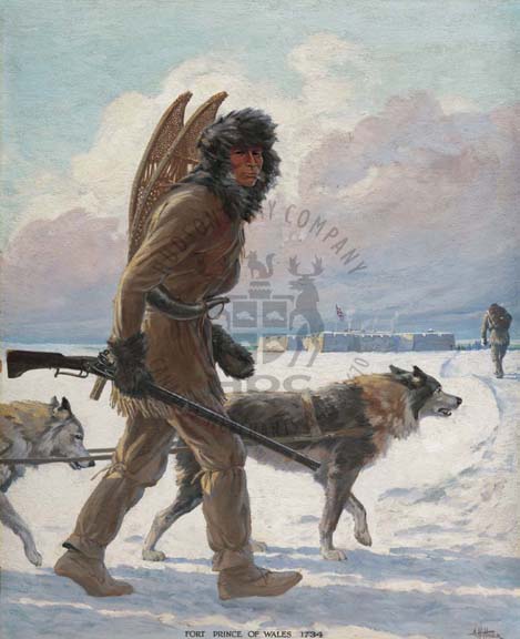
A trapper arriving at Fort Prince of Wales was a common sight during the dreary winters along the Hudson Bay shore. Soon after the Treaty of Utrecht in 1713 it became clear that a new fort was needed at the mouth of the Churchill River to protect the Company's assets in the event of a new war.
Construction began in 1732. Intended to replace the earlier fort that had been built on the opposite shore, its design was based on the popular European 'star' configuration with four protruding bastions, but its massive size and small construction crew made for slow progress: the fort took almost forty years to complete.
Fort Prince of Wales saw action only once, in 1782, when Chief Factor Samuel Hearne, the famous explorer, surrendered it to the French admiral de la Pérouse without firing a shot. After the victorious French spiked the guns and blew up the magazines HBC abandoned the fort forever.
Did
You Know?
Prince of Wales Fort is a national historic site that is now maintained by Parks Canada. It is located near Churchill, Manitoba. View a map of the building.